|
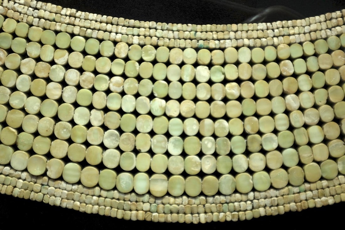
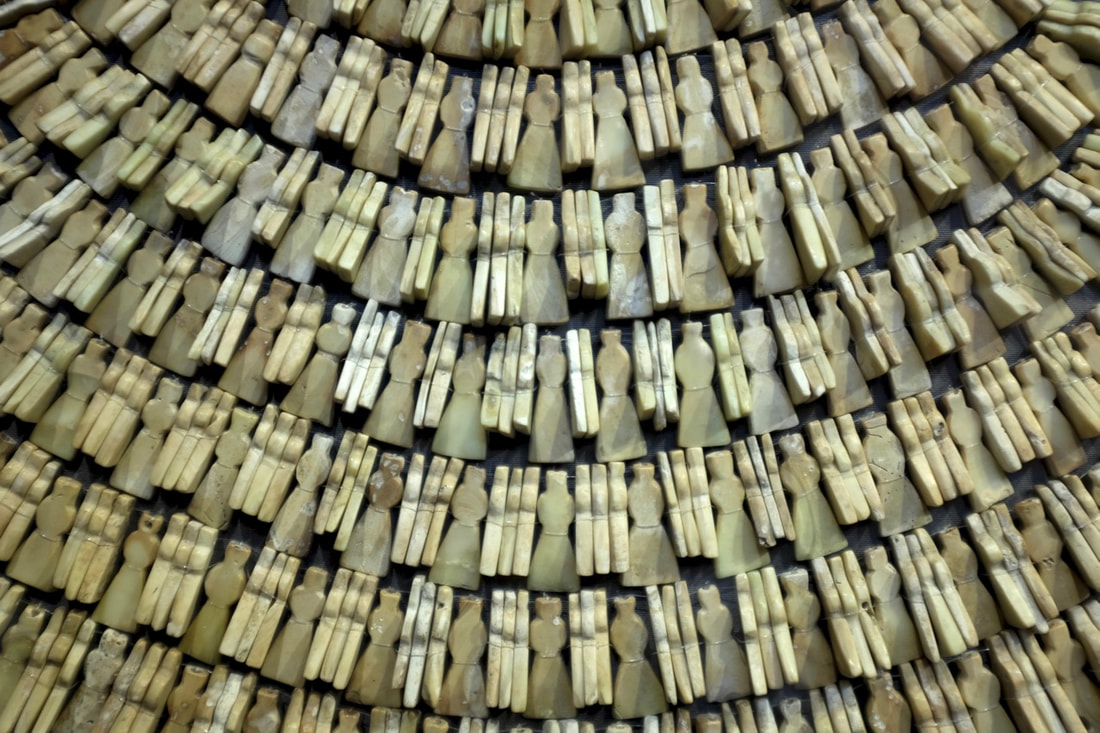
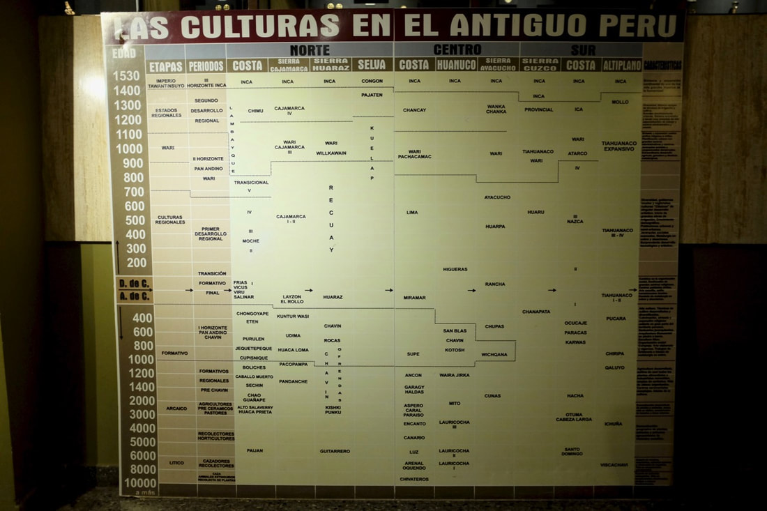
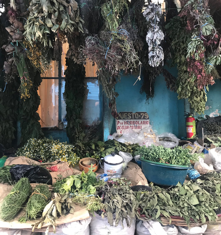
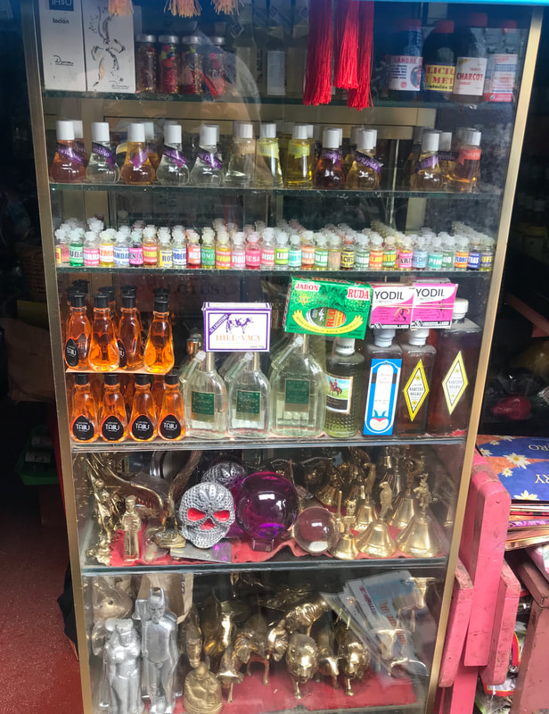
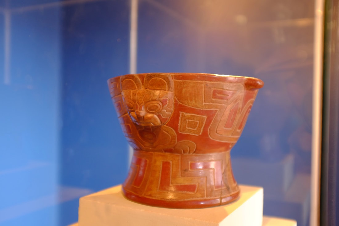
Chiclayo itself is a pretty big, busy town. There’s quite a lot to see fairly nearby, but, as with Trujillo, it’s hard to get to the archaeological sites without independent transport or taking a guided tour. We decided to go for the self-guided option and just went to the museums in Lambayeque, a 20-minute colectivo ride from town. This was easier than we’d feared: we were following the vague yet complicated instructions in the Lonely Planet to find the local bus station when I noticed that every couple of minutes we were passed by a white minibus with a sign for Lambayeque in the window. After a bit of arm-waving and a very brief negotiation in Spanish, we were crammed into the back of a van and on our way. The big local draw is the Moche site of Huaca Rajada, or Sipán. This was discovered by tomb raiders in 1987, but was closed off by police before it could be cleared out completely. The main tombs were entirely untouched, making this one of the most important recent archaeological discoveries in Peru. The Museo de Tumbas Reales has all of the artefacts from Sipán, in a building shaped vaguely like the tombs themselves. Like the Huaca de la Luna in Trujillo, Sipán is a Russian doll of a structure, with many layers (and tombs) added over time. The tombs are presumably of lords or priests, and contain opulent treasures: pottery vessels, spondylus shell jewellery, and enough gold jewellery to smother a donkey. There are also skeletons of dogs, llamas, and humans, some with their feet cut off, presumably so that they would be unable to flee from their guard duty, even in the afterlife. Sadly, though, the museum is also an amazing example of how not to interpret any of the things on display, so it’s very easy to get museum fatigue after endless rooms of treasure and bones. 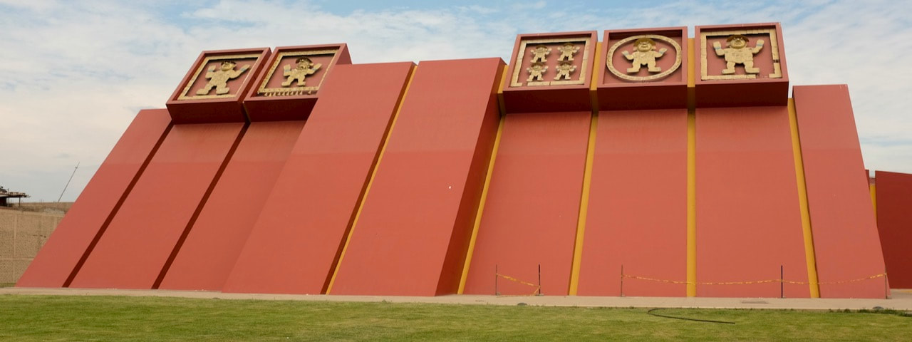 The nearby Brüning Museum is a lovely contrast. A rather faded, Le Corbusier-inspired, building contains the collection of a nineteenth-century German researcher. Again, it’s not great in terms of explanation, but it does, uniquely among all the museums we went to in Peru, have a complete timeline of what was happening where and when in Peru for the last 12,000 years. Almost all museums have some kind of timeline on display, but they’re irritatingly focussed on the immediate neighbourhood and the Catholic Church, to the exclusion of anything that might actually help you understand regional history. Fascinating though it might be to some, I really don’t care that the First Crusade happened at around the same time that the Chancay were replacing the Wari along The Central coast of Peru. Taking the colectivo back to town was easy: we walked down the road from where we’d been dropped off until somebody tried to sell us seats. We then waited for a few minutes, until they’d filled the bus. Of course, it then stopped to pick up more passengers along the way, but that’s clearly how things work. Chiclayo also has a large market, which has a section dedicated to supplying everything a local shaman, or brujo, could want. Nice for a quick wander around, but I don't think I'd want to pay for an actual guided tour. Logistics: S/1.50 per person each way to Lambayeque and back. A taxi would have been around S/40 each way, which means it would actually be cheaper to pay for every seat in the entire colectivo than to get a taxi. Both museums cost S/10 per person to get in. The Museo de Tumbas Reales has incredible security: you have to leave all bags, cameras, and phones in a locker, and get wanded down before you’re allowed in. Take some kind of photo ID along so that you can leave it in the locker: the attendant checks that it's actually you before letting you have your stuff back.
0 Comments
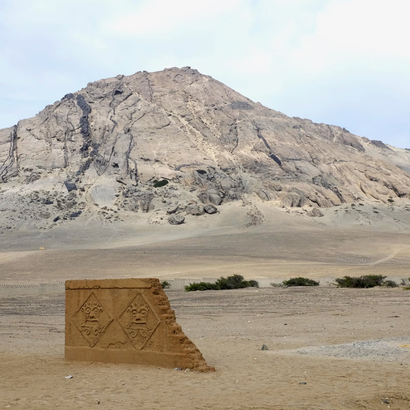
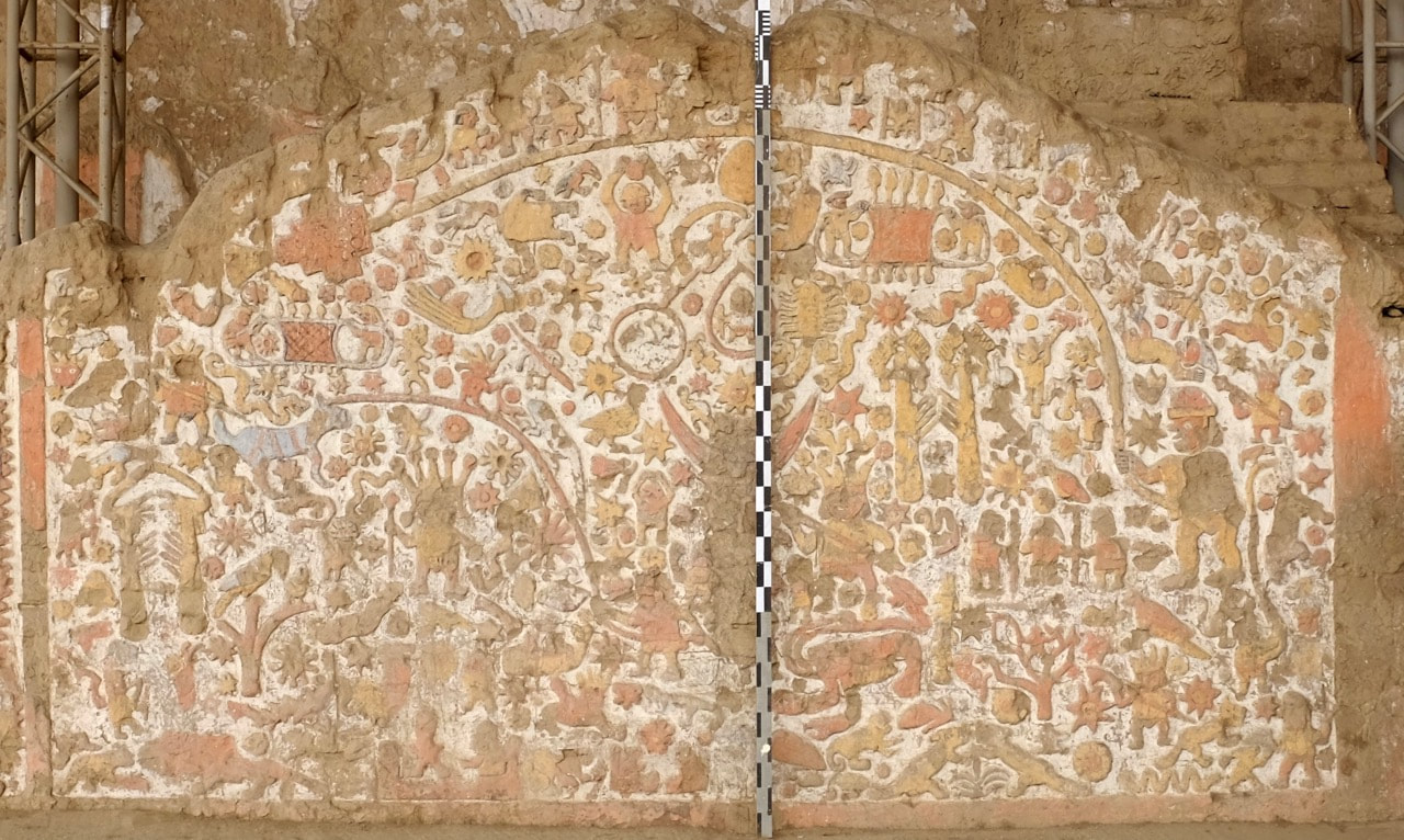
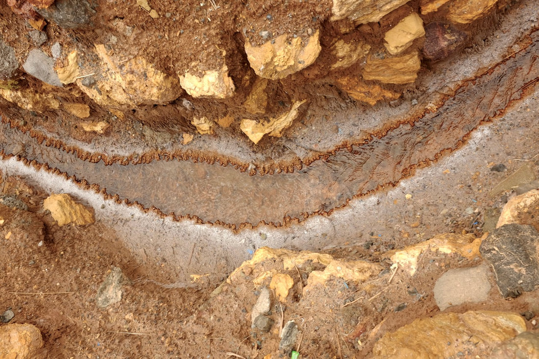
Water in the South Pacific tends to circulate counter-clockwise, driven by trade winds and the Coriolis effect. The Humboldt Current, consisting of cold water from the Antarctic, flows north along the coast of South America. This brings nutrients to the surface, making phytoplankton thrive, and so also the fish that feed on them. It also cools down the air, reducing its capacity to hold moisture, and so dries out the coast from northern Chile up to southern Ecuador. Very little rain falls in this area - Lima is the second driest capital city in the world, after Cairo - and many plants survive only because of dew forming at night. This counter-clockwise flow means that there’s a gradient in air pressure and water temperature across the Pacific, with the east normally cold with high pressure, and the west warm with low pressure. This varies throughout the year, with the east usually warmest around Christmas, which led fishermen to call this El Niño, in another example of the enormous influence of the Catholic Church in this part of the world. The flow of cold water will sometimes diminish or stop for months at a time, bringing hot moist air, and lots of rain, to the coast in what, once it’s lasted for long enough, is called an El Niño Event. The diminished Humboldt Current also means less food for phytoplankton, which can have serious effects on fish stocks. So, if you happen to live, say on the north coast of Peru, in a house of adobe bricks, and eat fish and whatever you can carefully grow, an El Niño event can be pretty catastrophic. Your fields are waterlogged, your home is being washed away, and there aren’t any fish to catch. 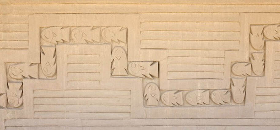 The picture above is part of a (restored) wall at Chan Chan. A smaller adjacent wall has the same pattern with the fish going in the opposite direction, north to south. This, we were told, shows that the Chimú understood that the Humboldt Current usually brings fish from the south, but sometimes El Niño reverses the flow.
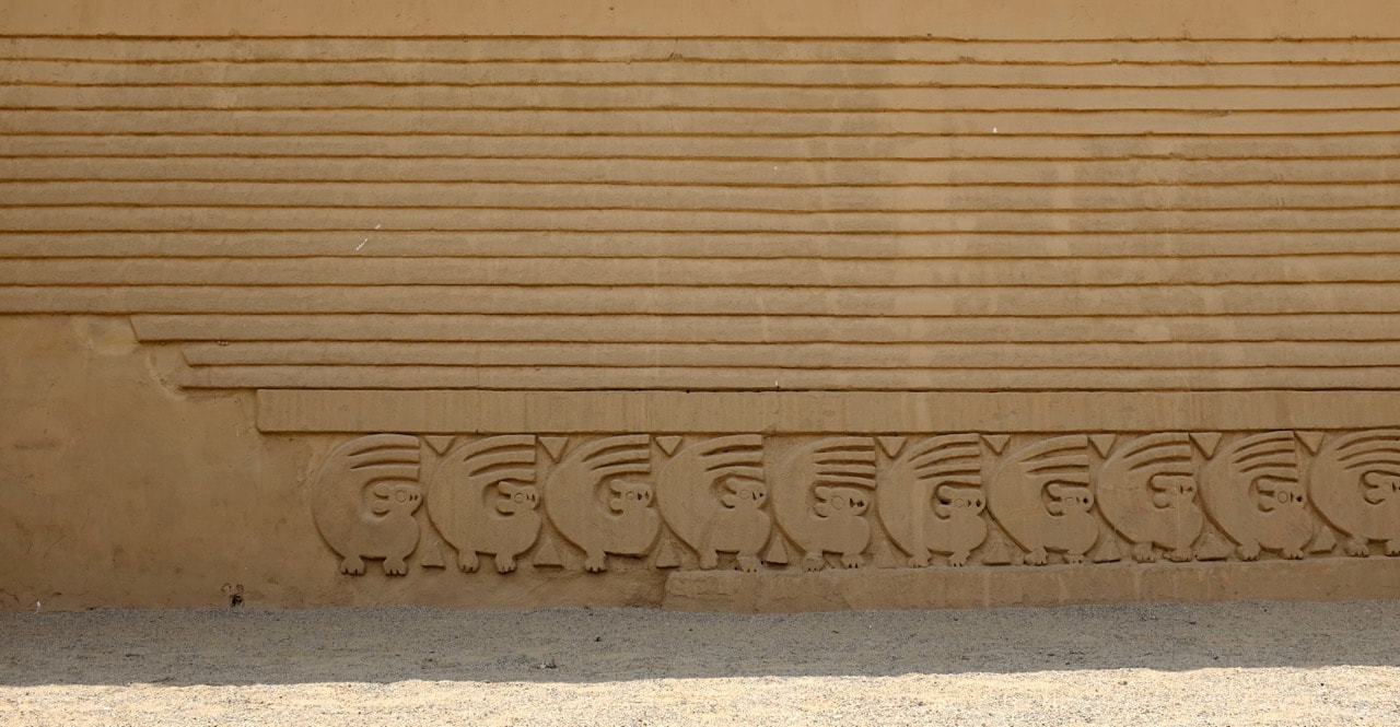
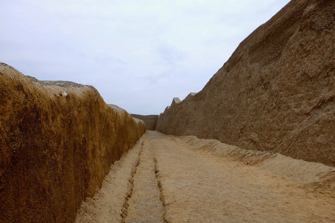
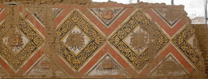
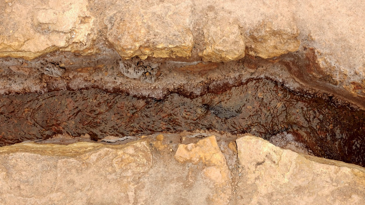
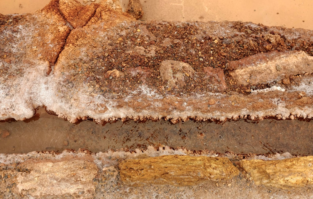
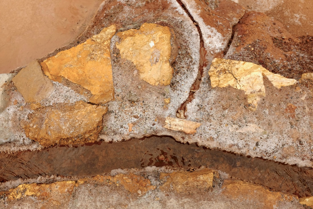
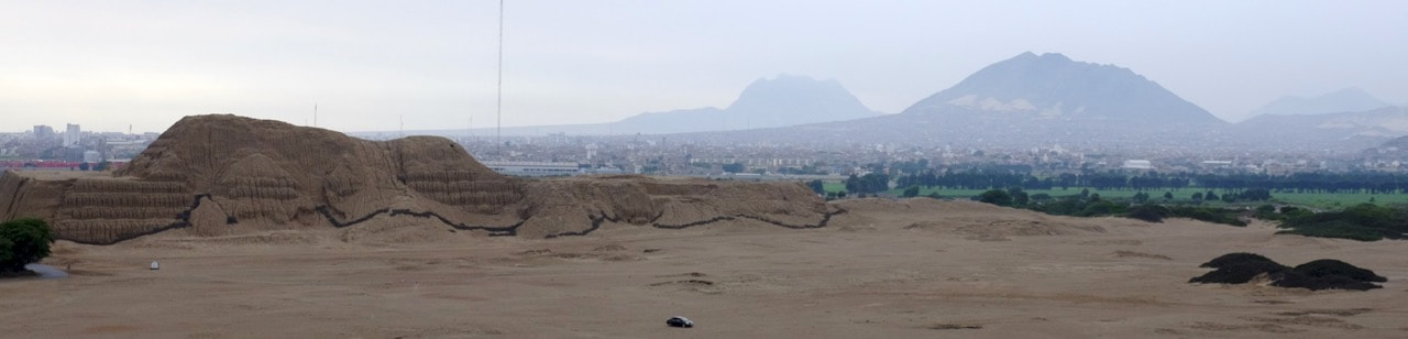 Huaca del Sol - note cars in foreground for scale Pisco Sour Day officially falls on the first Saturday in February in Peru. Rather than going out drinking, though, we took the night bus to Trujillo. This represented a big change: rather than booking everything weeks in advance, and spending up to a month in one place, we started a new phase of travel, only reserving the next hotel, and only for a few nights at a time. This meant that we spread out our planning, rather than doing it in chunks, and gave us more flexibility to move on when we were done with a place, rather than having to stick to a schedule. Trujillo, third-largest city in Peru, was named after the home town of notorious shitbag Francisco Pizarro. We initially thought it might be worth staying for four nights, but we only booked three to start with, and were quite happy to move on after that. The colonial centre of town is remarkably well preserved, but the main attraction is the archaeology. The Moche people ruled the north coast of Peru from here around 100-700 CE. Outside Trujillo, they left what now look like two massive hills of mud. The Huaca del Sol was the largest pre-Columbian structure in Peru, but was looted and partially destroyed by the Spanish. Now, as you can see from the photo above, it is suffering badly from erosion when it (occasionally) rains. The Huaca de la Luna is better preserved, and has been excavated on and off for the last hundred years. It is actually five iterations of the same building, built over each other like Russian dolls. This pattern of reconstructing buildings on top of each other is seen elsewhere in Peru, including at Sipan and Huaca Pucllana: I suppose it's a lot easier to build a massive temple that way than by starting from scratch. Here, it means that a lot of what were once external murals have been preserved by the outer layers. Some interesting anti-seismic techniques were used when filling up the old buildings: rather than using rubble or laying complete courses of brick, large stacks of brick were laid next to each other, presumably to allow motion during earthquakes. The Moche civilisation died out some time in the eighth century, probably falling apart after a series of severe El Niño years meant that there wasn’t enough spare labour to spend on building enormous temples for priests who couldn't stop it raining. Restored wall and details of murals, Huaca de la Luna The Chimú culture arose around a hundred years after the decline of the Moche. The city of Chan Chan was first constructed 850 CE, and is now the largest adobe city in the Americas at around 20 square kilometres. Each of ten Chimú kings built a walled ciudela to live in and rule from, abandoning the old quarters. The city fell into disuse after the Chimú were conquered by the Incas in 1470. This was only fifty years before the arrival of the Spanish, who thoroughly pillaged the place. Part of the site has been restored, but much of it is just washing away every time it rains. Walls at Chan Chan (restored and unrestored) There appears to be very little left to show how ordinary Moche or Chimú lived - or Inca, for that matter. Almost everything displayed in the museums was found in elite graves, and many of the non-elite remains documented were human sacrifices. I don’t know whether this is because archaeologists have been concentrating on high-status sites, or that ordinary people aren’t exciting enough to put in museums, or even to mention much of the time. The millions of adobe bricks that were used to build the Huaca de la Luna have what seem to be makers’ marks on them, hypothesised to be evidence that families or groups paid some kind of tax by making bricks. Details of Huaca de la Luna: murals of Mochica chief deity Ai aipaec and anti-seismic brick stacking Logistics: Cruz del Sur overnight bus S/90 each in the VIP section. Good reclining seats with personal video screens, but a pretty bumpy journey.
We went to Chan Chan and the Huacas on a full-day tour by Colonial Tours for S/175 each, booked by turning up to their office. If you take this, don't eat lunch at the restaurant that they stop off at: we had a miserable and overpriced meal there. It was a good way of getting to see everything quickly, but we often had the sense that we were being herded around - literally, in the case of the museum at the Huacas, where we were given half an hour and then shooed back onto the bus. Getting a bus ticket onwards to Chiclayo was a nightmare: the Lonely Planet had the wrong address for where we could buy tickets, and we didn't realise that we needed to bring passports, so we spent a whole afternoon wandering around town. The travel agent on the Plaza de Armas does sell tickets, though. Food: Las Mollejitas serves (only) chicken gizzards fried in butter. Cheap, and well worth queueing for.
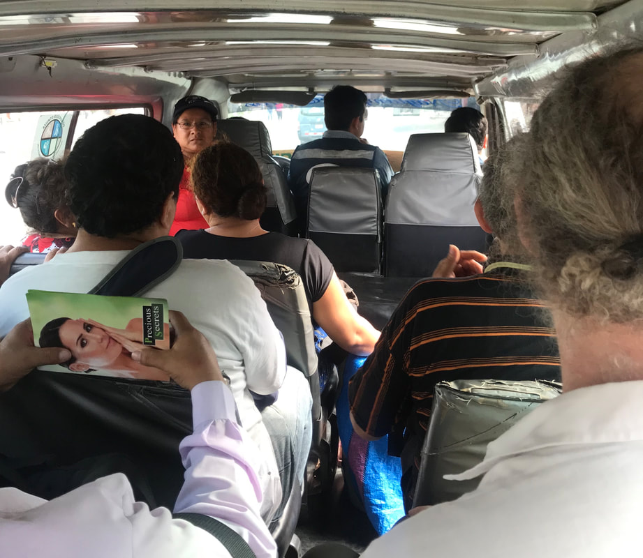
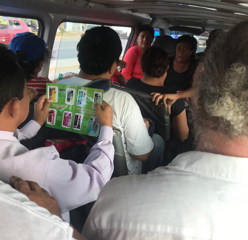
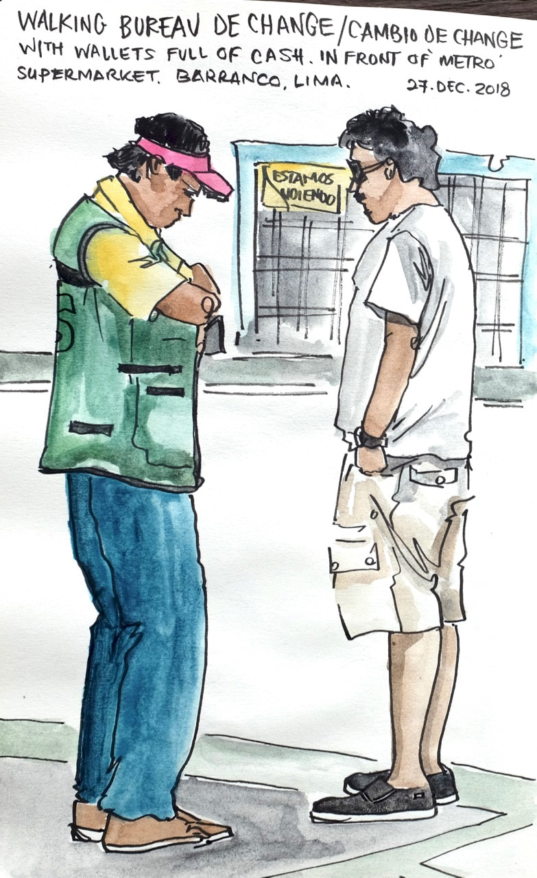
There were always half a dozen people outside our local supermarket in Lima, wearing turquoise waistcoats and brandishing bricks of banknotes. Cars would pull over, and money would change hands after a few seconds’ bargaining. This mostly seemed to be people selling US dollars for soles, but I can’t figure out quite why. Most ATMs in Peru give you the option of taking out USD or PEN - is this because people still remember when the old sol went through the floor and was replaced by the inti in 1985 (1,000 PES = 1 PEI) and then again in 1991 by the new sol (1,000,000 PEI = 1 PEN), even though things have been pretty stable ever since? Or perhaps because a lot of Peru is still a cash-based economy and it’s hard to take out more than a few hundred soles from the bank at once, so Benjamins under the mattress are a good store of value?
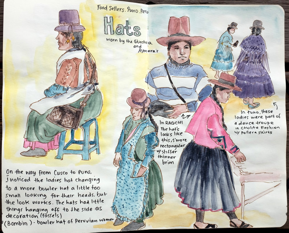
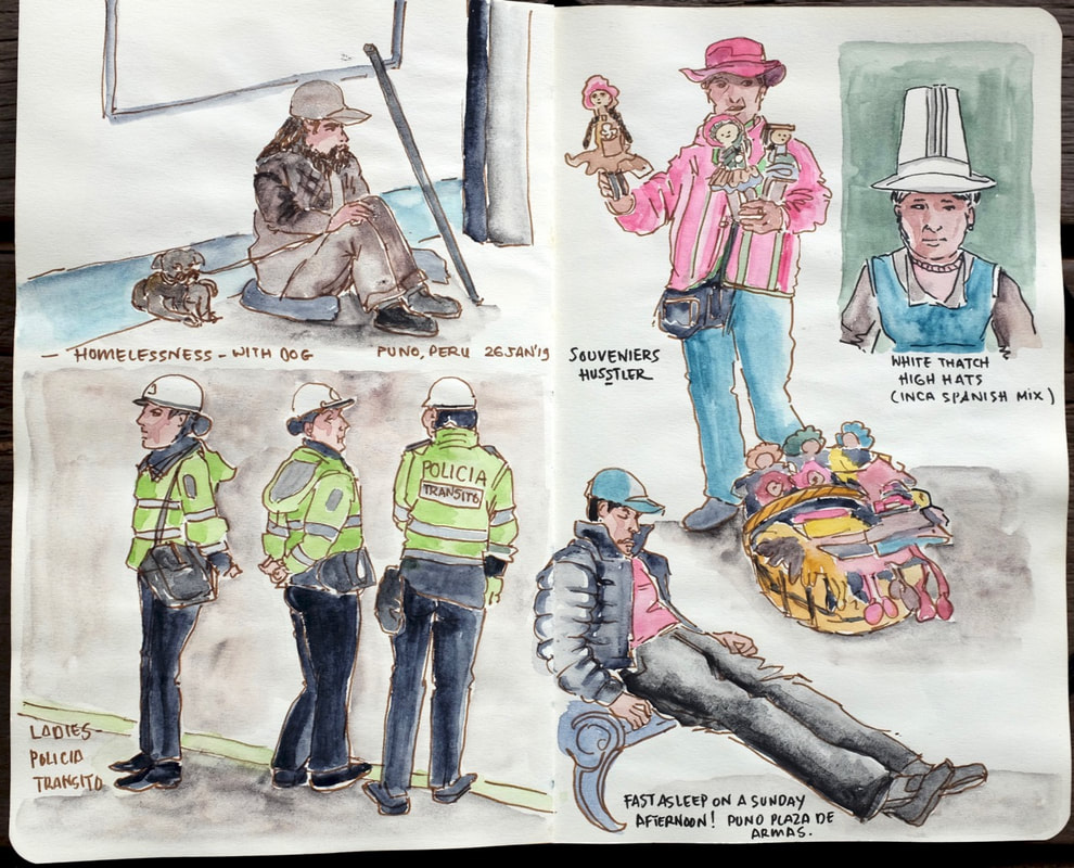
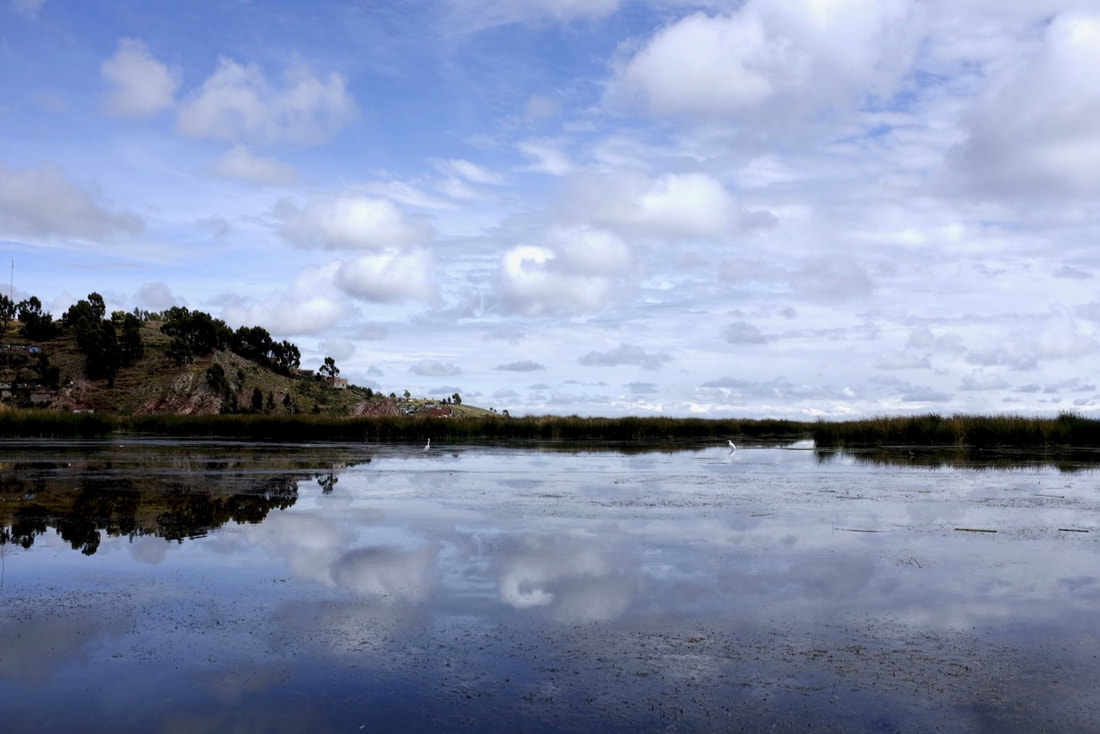
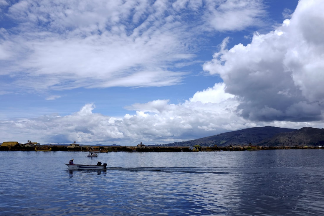
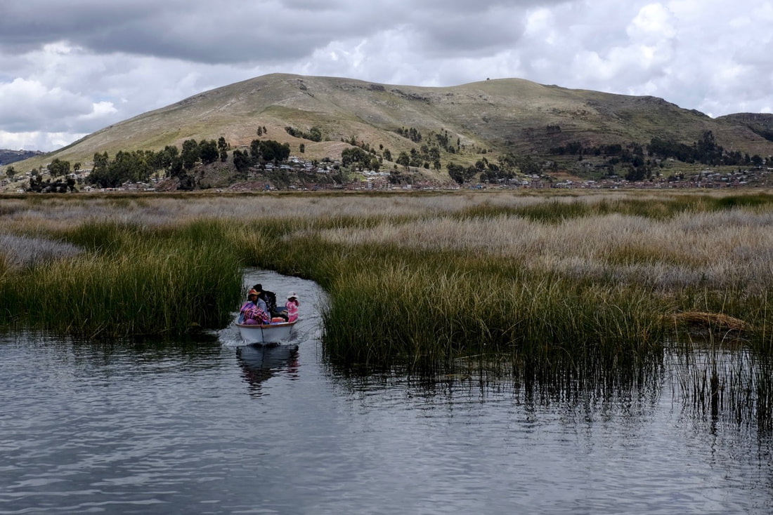
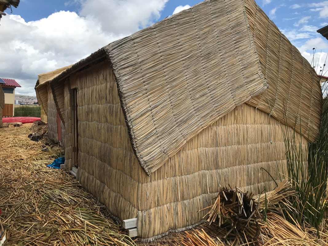
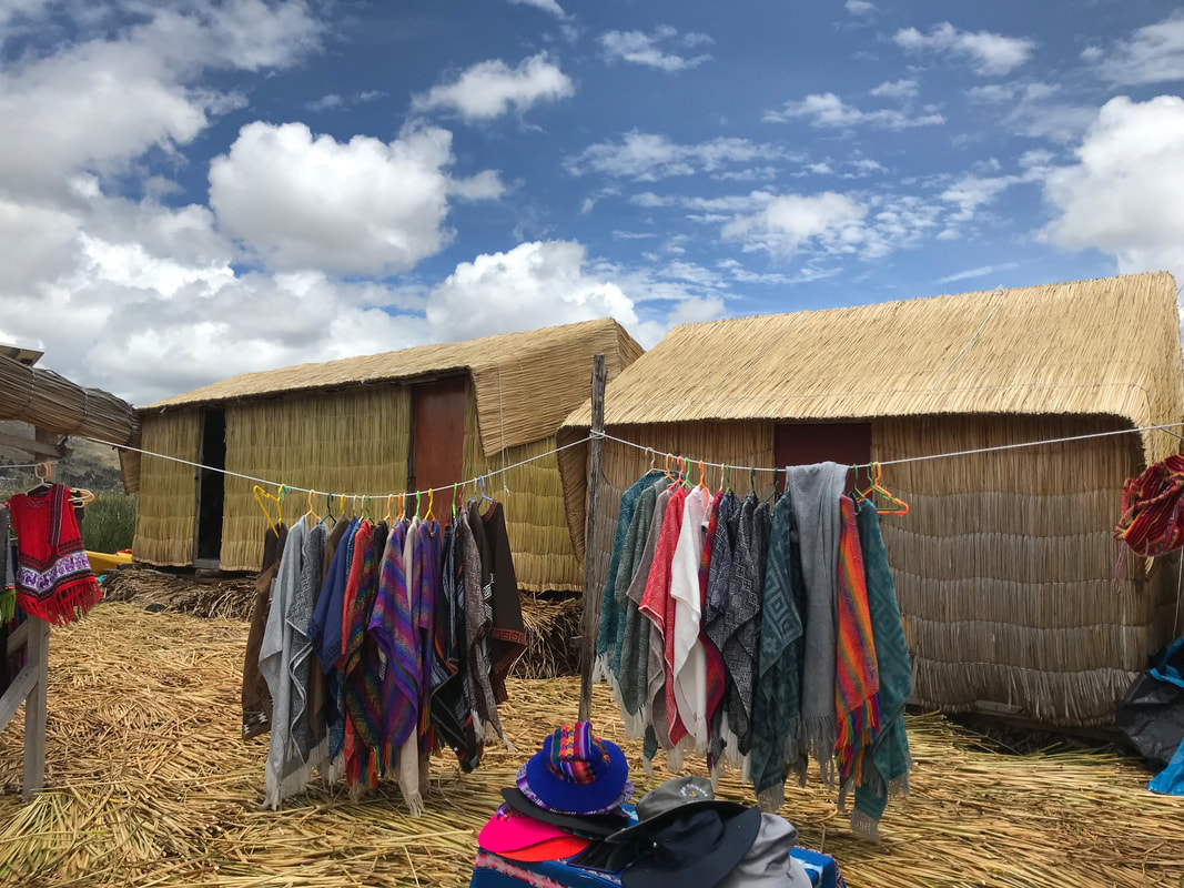
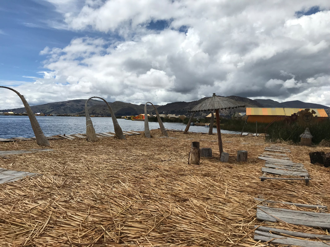
A word to the wise. Change your money in Peru if you can, and definitely don’t cross the border to Ecuador with more than pocket change left in soles, because it will be difficult and expensive to change. Peruvian money changers will happily give you $50 and $100 notes, but, despite being legal currency, nobody likes them in Ecuador and even big businesses may refuse to take them. 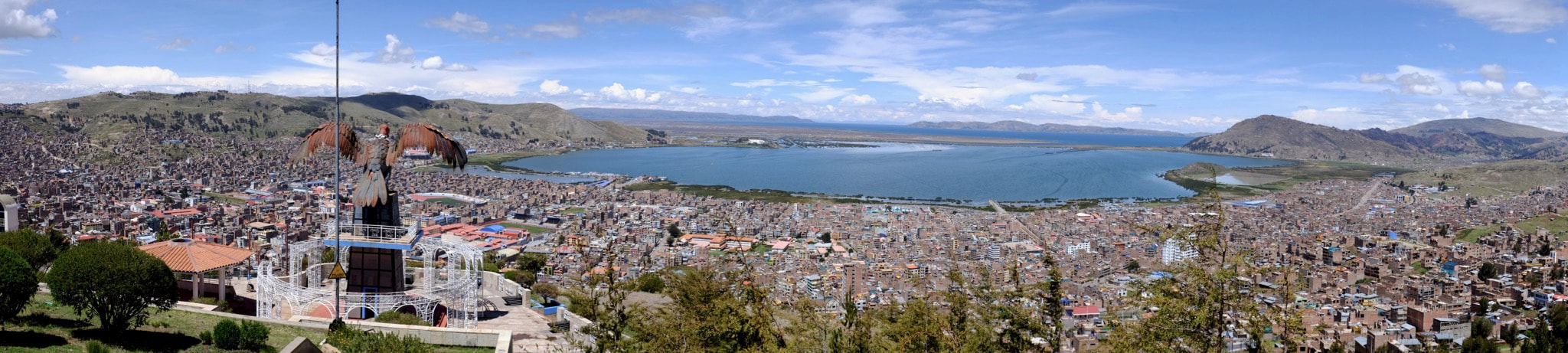 Puno is the Peruvian gateway to Lake Titicaca. The city itself is a bit sad. The impressive colonial Plaza de Armas is surrounded by a few streets of restaurants aimed at tourists, and then the city sprawls up the hillsides, getting poorer as you go higher. The altitude (3,830m above sea level - a good fifty-odd metres above the summit of Mount Fuji) made it very hard to do anything strenuous. I had a continual headache and often felt dangerously out of breath, even when sitting down. We managed to climb above the city to the Kuntur Wasi viewpoint one day, where there’s a huge metal sculpture of a condor. Slightly further up the hill we found a grassy plateau. Despite now being higher than Mount Kinabalu, there were two dozen locals vigorously practicing an elaborate dance. We were continually told that Lake Titicaca is the highest navigable lake in the world. This is only really true if you define “navigable” to mean “by ships at least as big as the ones on Lake Titicaca”, and seems to be a strangely specific claim to stake. Is being the largest lake (by both volume and area) in South America not enough? Core samples show that the lake dates back at least 370,000 years, and it may be up to 18 million years old. Its water never makes it to the sea: 90% evaporates from Titicaca, and the 10% that escapes by river to Bolivia evaporates in the fast-disappearing Lake Poopó. There are several islands that you can visit, most interestingly the floating Uros islands, which are moored slightly outside Puno. These are continually built out of totora reeds harvested from the lake, with new reeds being added to the top as the ones on the bottom rot away. Reeds are also used to make boats, although fibreglass seems to be increasingly popular. 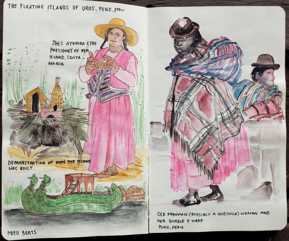 We kayaked out to the Uros through tiny channels in the reed beds that separate Puno’s port from the main lake. This was an excellent way to see the lake, and some of its wildlife, from close up. Once at the islands we were given a demonstration of how the islands are built, and then offered the opportunity to buy snacks or souvenirs. Susan came away with a nice pair of alpaca hand warmers for S/20, so everybody came out up on that deal. Candlemas, in early February, is the big annual festival in Puno. There’s a large folk dancing competition, which I surmise that the dancers we saw practicing earlier were going to be part of. Sadly, we had booked our tickets back to Lima without checking what was going on, and had to leave town just before it started. Even if we could have changed the flights, though, I don’t think I’d have wanted to stay a lot longer. The lure of going back to sea level was just too strong. 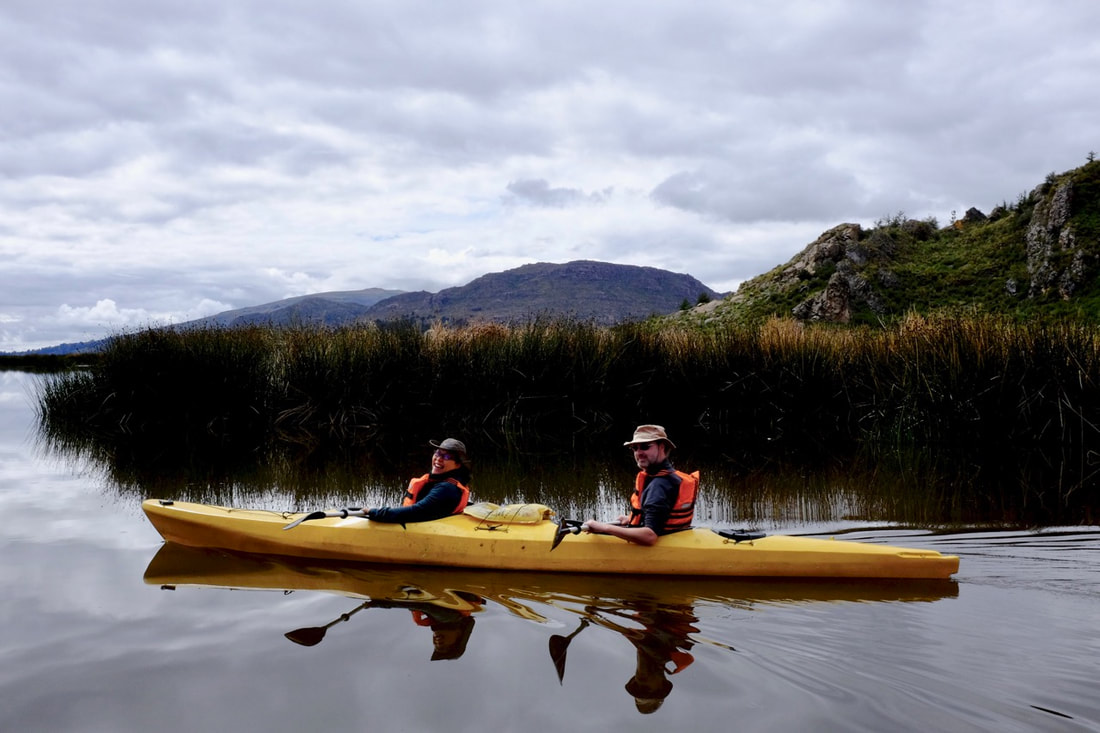 Food tips: we stumbled on the Casa Grill, a Peruvian barbecue place with a signed picture of AC/DC on the wall. Excellent value, but not recommended for vegetarians. All the other restaurants we ate at seemed to be aimed at tourists and either overpriced (Mojsa) or extortionate (La Table del’ Inca). The Cafe Bar de la Casa del Corregidor, just off the Plaza de Armas, has a nice courtyard and is an excellent place to spend an afternoon when you’re all canoed out.
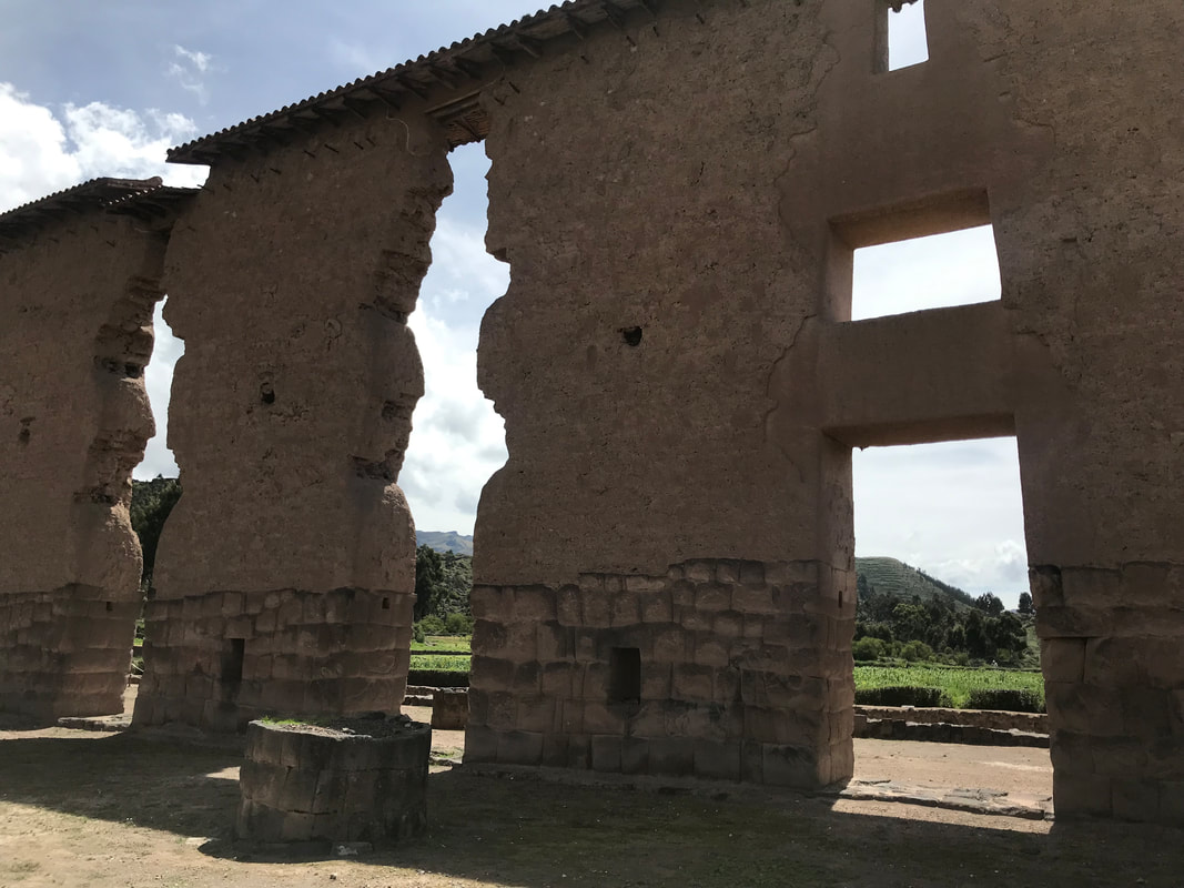
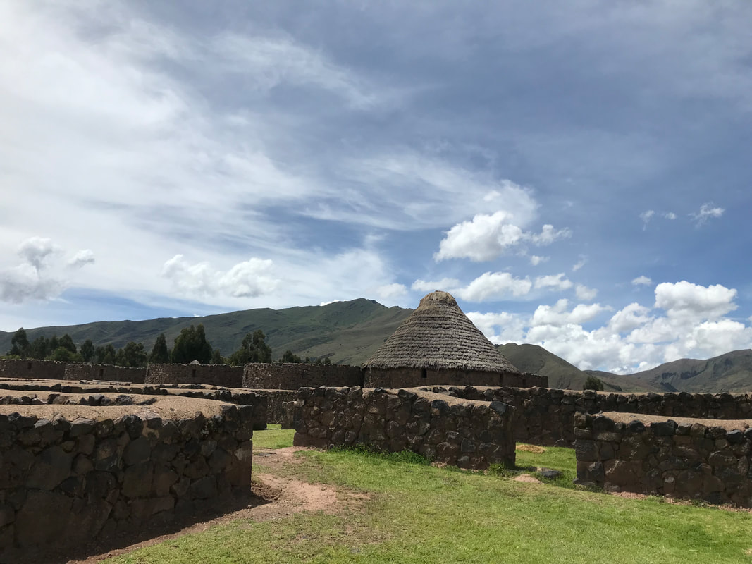
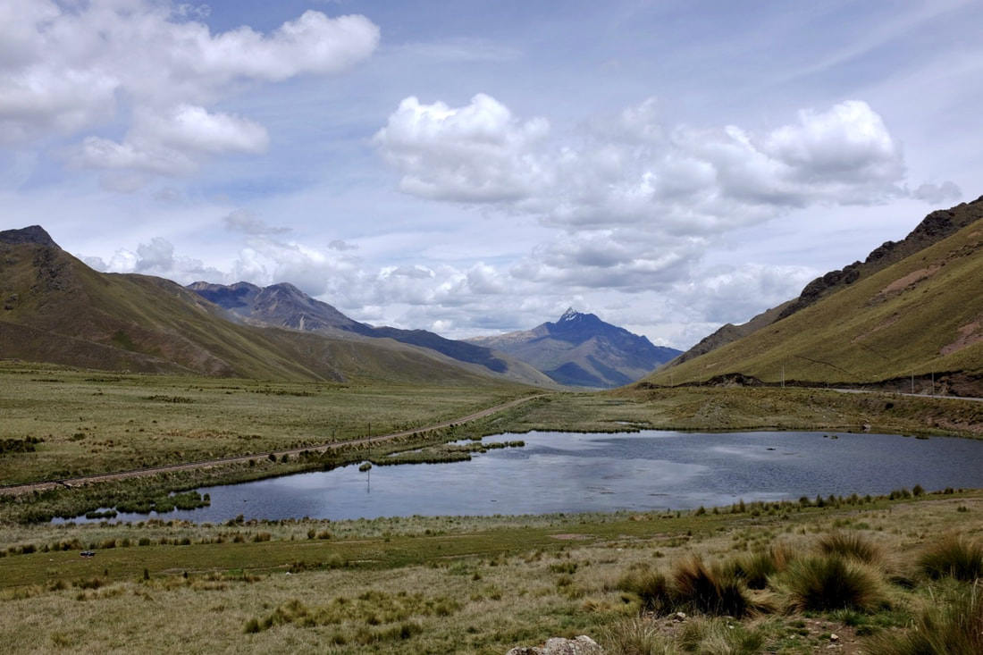
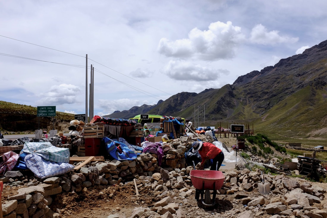
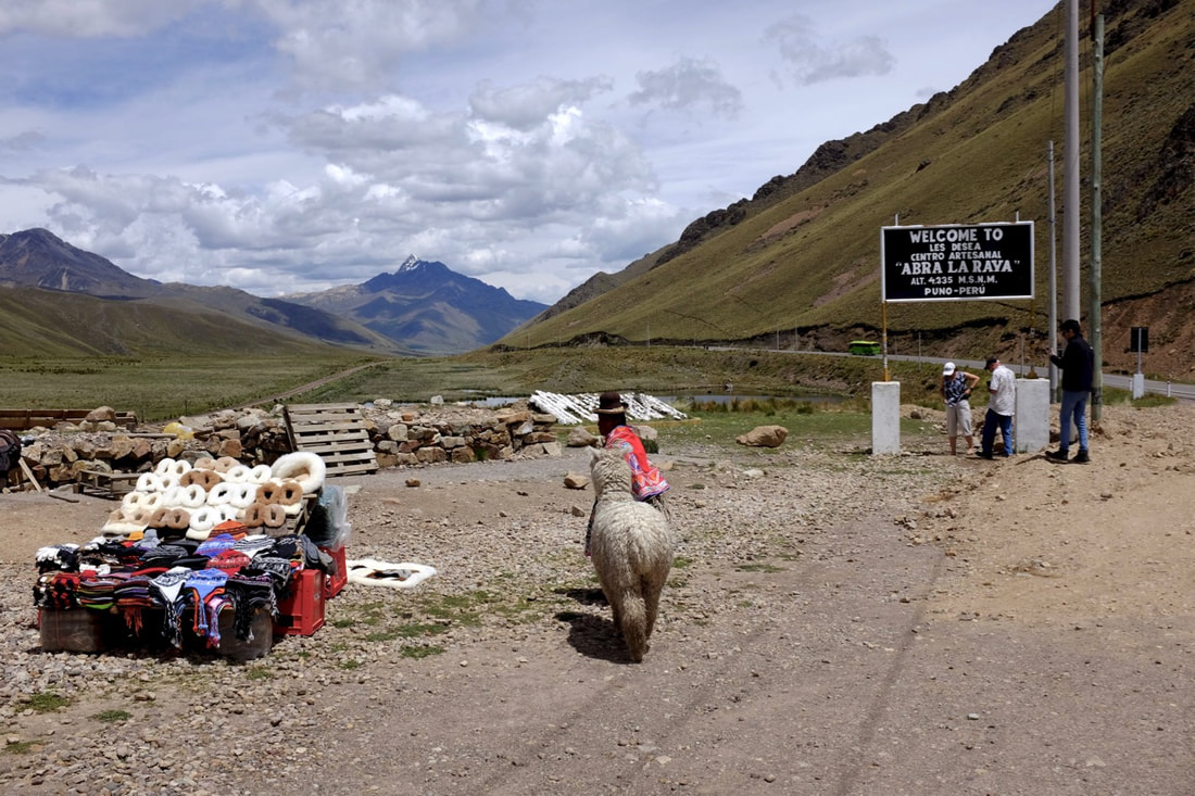
Logistics: the kayak tour for two was S/348 including a tip for the guide, via Edgar Adventures. We booked by walking in to their office and asking if they could take us the next day. Our flight out left from Juliaca airport, an hour away from Puno. Our hotel tried to book us an expensive taxi but we persuaded them to reserve tickets on the shuttle bus for S/15 a head. This came to the hotel at the right time but then spent almost an hour driving around town to pick up more people, so if you like to be at the airport two hours before a flight then you should leave plenty of time. Juliaca airport is small and easy to check in, and we had no problems even though we only got there just over an hour before the flight left. Aeroplane nerdage: the air pressure at the airport is around 650 mbar; significantly lower than cabin pressure at cruising altitude. Shortly after takeoff (or possibly as soon as the engines spun up for takeoff - my iPhone pressure app isn't terribly responsive) the cabin pressure started increasing steadily, much as it does when an aeroplane is coming in to land somewhere normal, until it reached around 750 mbar, which seems to be fairly standard. Now I just need to fly on ANA again to check whether they really do have better cabin pressure than everybody else. There are a couple of options for getting from Cusco to Puno: the ordinary bus and the tourist bus, which has nicer seats and stops along the way for lunch, and to let you see some of the sights that would be hard to get to otherwise. The church of San Pedro Apóstol in Andahuaylillas, 40 km outside Cusco, was built by Jesuits in the sixteenth century. Of course, it was built on a site that was sacred to the people who lived there, and blinged up to an amazing degree. Everything inside that’s not gold leaf is covered in murals, mostly created by itinerant Andean painters in the seventeenth and eighteenth centuries. These were seen to be the best way to evangelise the local population, especially as they incorporate a lot of indigenous images and symbols. They don’t allow photography, so here’s what it looks like from outside. The Temple of Wiracocha at Raqch’i, 80 km further on, may have had the largest single gable roof in the Inca empire. Now, all that stands of it is the central wall and the remains of some pillars. Living quarters and storehouses surrounded the temple. Some of the site is being restored, so there’s not a great deal to see apart from walls, but it’s a good leg-stretch to break up the journey. After lunch, and several hours’ driving up through the altiplano, we reached the pass at La Raya. This is the highest point of the journey, at 4,335 m above sea level. There’s a great view, a rather sad craft market, large piles of rubbish, and yet another opportunity to have your photo taken with a llama. The air pressure was just a shade over 600 millibars, so we moved slowly, took a few pictures, and got back on the bus. The town of Pucará is built on the archaeological site of Pukara, which dates back to approximately 2000 years ago. The Lithic Museum is small and not terribly spectacular compared to many other Peruvian museums, but it’s good to see that the Incas aren’t completely monopolising the attention of researchers. There's also a Spanish church with a very impressive dome, but it was completely locked up. 60 km further on is the city of Juliaca, a major centre for petrol smuggling and financing informal gold mining. Everybody says to avoid it unless you must, which seems like good advice.
Logistics: USD 40 per person for the bus tickets from Inka Express plus S/50 for entrance fees. There's another company that runs the same route for approximately the same price, but I think they left even earlier in the morning. 
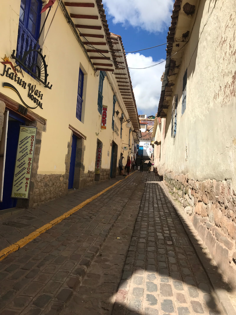
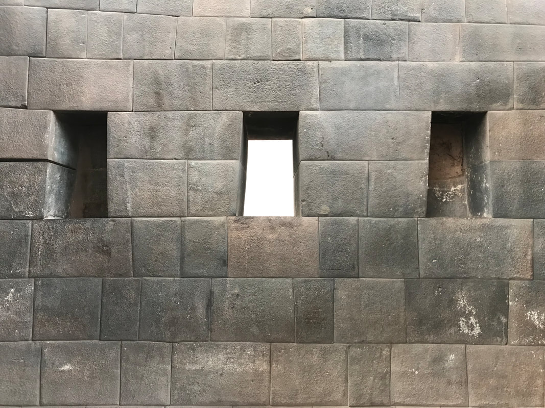
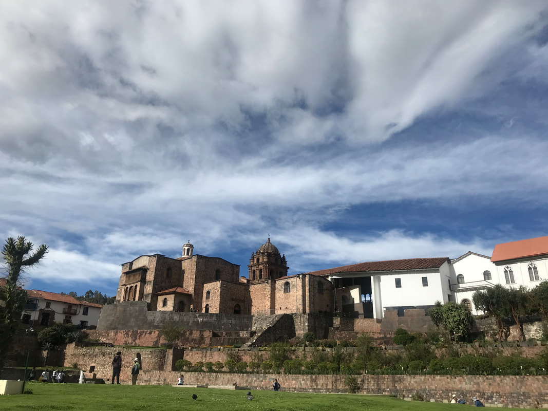
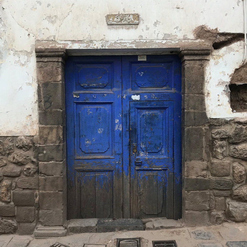
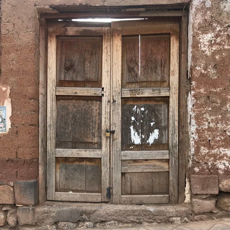
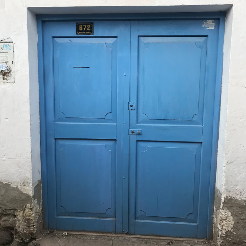
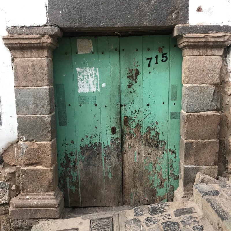
Streets of San Blas There was a local festival one of the days we were there, which started with letting off fireworks in the middle of the night, and continued all through the next day and night with brass bands, more fireworks, and some serious day drinking. The guy with the pyrotechnics had clearly been on the piss for several hours when we went to investigate at around ten in the morning. Every so often, he would produce a few rockets and launch them from the middle of the square. You couldn't see anything, but the explosions were loud enough to set off car alarms. This happened several times an hour, from around four o'clock that morning until he either ran out of explosives or died of alcohol poisoning around midnight. 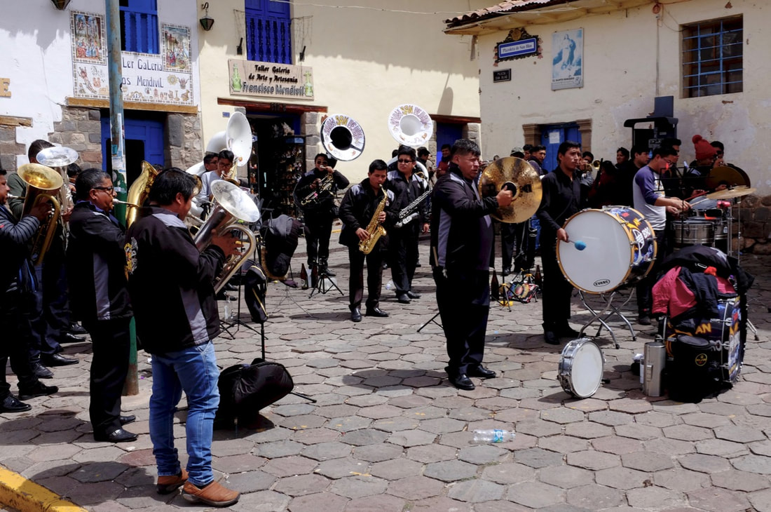 The city is full of museums, of varying quality. We went to the Qoricancha Site Museum because it was included in the boleto turistico, and because there's a nice little park behind it that you can only get to by going through the museum (or by dodging security guards). This was possibly the worst museum I've ever been to: a dank underground bunker with a strange collection of artefacts that looked to have been salvaged from another museum's bins, and with explanatory text written by a class of bored 11-year olds. The Museo del Convento de Santo Domingo Qoricancha is completely different, and well worth seeing. This was once the most important Inca religious site, with amazing stonework and walls literally covered in gold. The conquistadors pillaged all the gold then tore most of it down, and built a Dominican church on the foundations, which has magnificently weird paintings inside. All the angels are portrayed as Andean children (one wearing a very cute Elmo sweatshirt), and above the choir stalls there are superbly detailed pictures of saints and important Dominicans all looking as though they're about to smite some serious evil. Or are possibly auditioning to be part of a new Christian-themed fantasy trading card game. They don't allow photography or sell postcards, though. Inside and outside the Qoricancha museum The Centro de Textiles Traditionales de Cusco, just down the Avenida del Sol from the Qoricancha gardens, is definitely worth a visit. There's a small museum gallery that does a very good job of explaining local textile traditions, and a lovely shop that often has women weaving or sewing. I picked up a lovely scarf of undyed alpaca that had been hand woven by a woman called Felicitas Huaman Quillahuaman in Chinchero. Some doors The Museo Histórico Regional de Cusco is in the house of Garcilaso de Vega, the son of an Inca princess and a conquistador. He lived in Spain for most of his life, and wrote important chronicles of Inca history and culture. Sadly, the museum suffers from the tendency to cram as much in as possible without much explanation, but the building itself is well worth the visit. There is an interesting room focussing on local cuisine, with a Cusco-school religious painting showing guinea pig being served at the Last Supper. 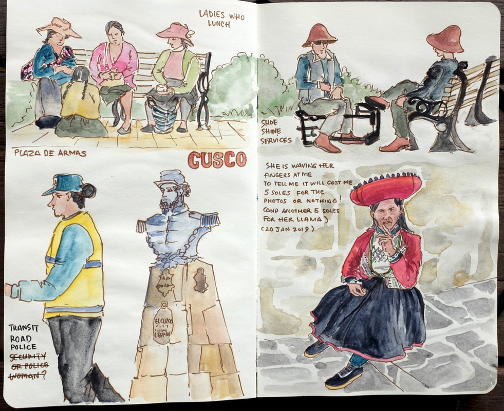 Cusco is definitely a tourist town. There are lots of people on the street trying to persuade you to eat in their restaurant, and women in traditional clothing demanding money for photos. Several of them had beautifully well-groomed llamas with them.
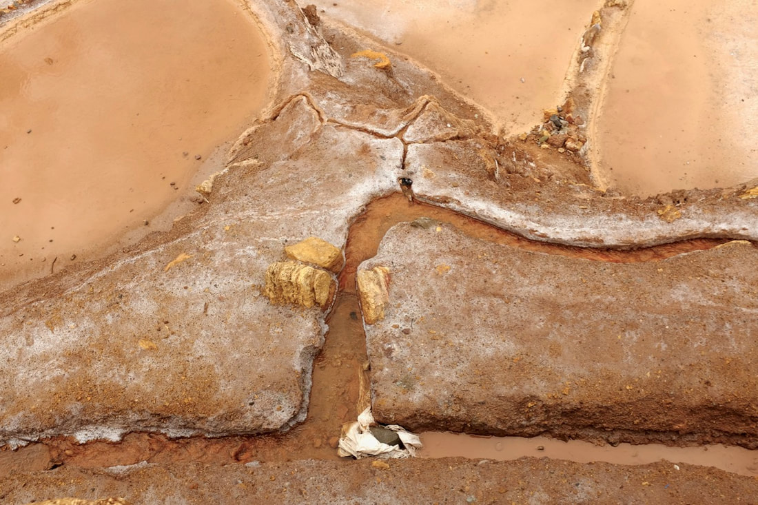
Food notes: we had surprisingly good Indian meals at Cafe Carvalho and Maikhana; tasty high-end chifa at Kion; and disappointing Japanese at Kintaro. La Bondiet makes great empanadas, and Papacho's was good, if not exactly cheap. A few miles down the road from Moray, the Maras salt ponds have been run as a local cooperative since Inca times. 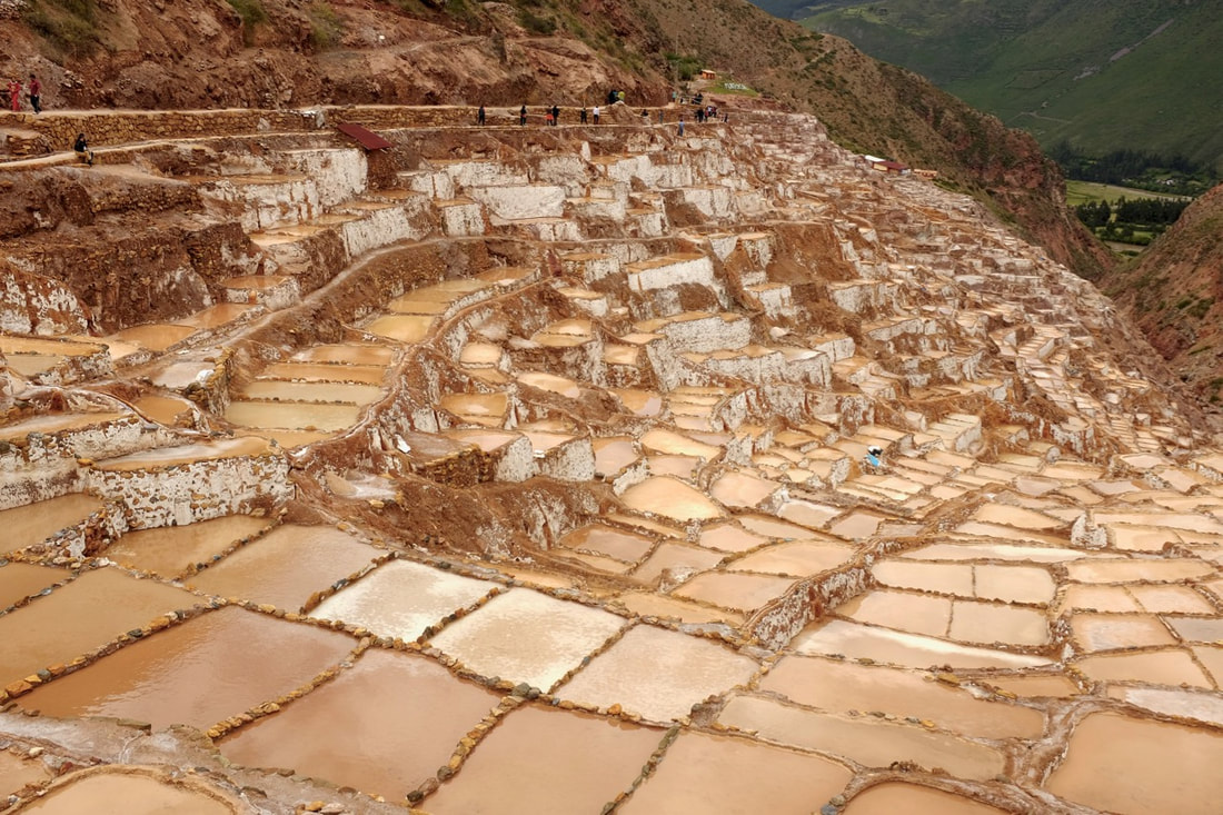 Ocean waters were trapped inland around 110 million years ago by the rising of the Andes, and evaporated to form underground salt deposits. Now deep underground, these deposits dissolve in groundwater, which rises as a small spring, and is diverted down a network of channels into evaporation ponds. Once a pond is full, the salt farmer diverts the flow and waits for salt to crystallise out before scooping it up and repeating the process. There are several grades of salt, depending on the skill of the operator and how much insoluble crud is left in the crystals. There are dozens of stalls selling salt in bags of all sizes, from as little as 1 sol for a couple of ounces. For reference, half a pound goes for USD 12 on Amazon. Oddly, nobody mentioned the fact that a unique bacterium, Salicola marasensis, was recently found living in the evaporation ponds. This is so halophilic that it cannot grow in solutions of less than 10% NaCl, and was the first species of its genus to be discovered. We also saw an enormous Nativity scene made almost entirely out of crystallised salt in one of the nearby buildings. It was quite disturbing, and we were both too unsettled to take a picture. The network of channels is fascinating, with small streams constantly branching off to ponds or to smaller networks. I spent a long time engrossed in the textures. We visited as part of our day trip from Ollantaytambo. The boleto turistico is not valid for entry: instead there's a charge of S/10 per person.
The Moray archaeological site consists of a small collection of circular terraces sitting in small depressions on a high plateau above the Urubamba valley, around 3500m above sea level. There is a sophisticated irrigation and drainage system that still works: local farmers planted crops in the terraces as late as the 1970s, before the site was handed over to the National Institute of Culture for preservation. 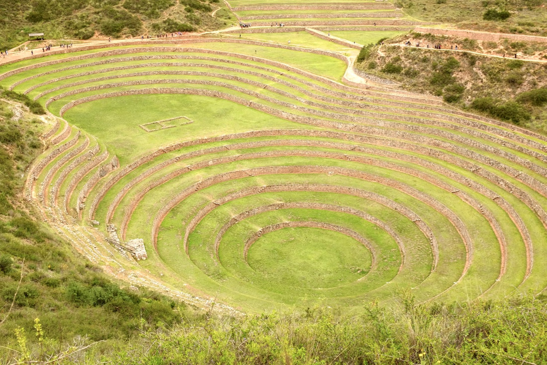 The terrace walls absorb heat from the sun during the day, and shield the lowest levels from wind, meaning that there can be a temperature difference of as much as 15 Celsius between the top and the bottom. Most archaeologists believe that these terraces were used as an experimental farm by the Incas, to simulate growing conditions at a range of altitudes and determine where different crops would grow best. I also found references to (unnamed) studies that are claimed to show that soil was imported from different parts of the Inca empire, which would support this theory. Other theories suggest that Moray was a religious site, or, less plausibly, a landing pad for UFOs. The best source I found on line was an article by Roger Atwood in vol. 60 #5 of Archaeology. If you'd like to do more research, then please do let me know what you find out. 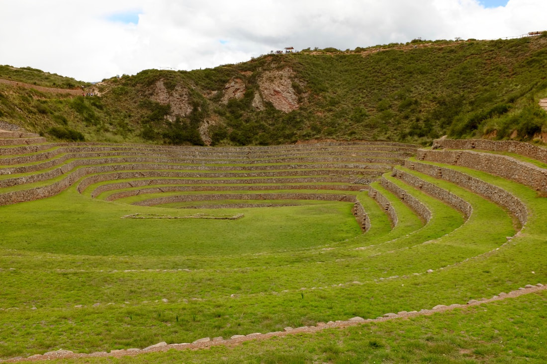 We visited Moray on a day trip from Ollantaytambo. Our hotel organised a driver for S/140, which also got us to Chinchero and the Maras salt mines. Entry is by boleto turistico.
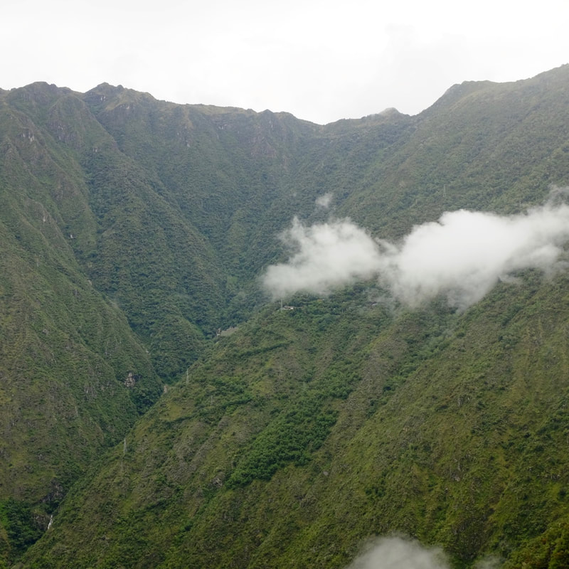
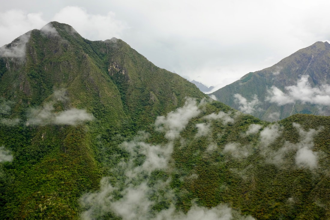
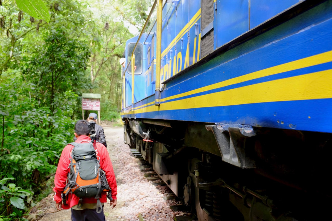
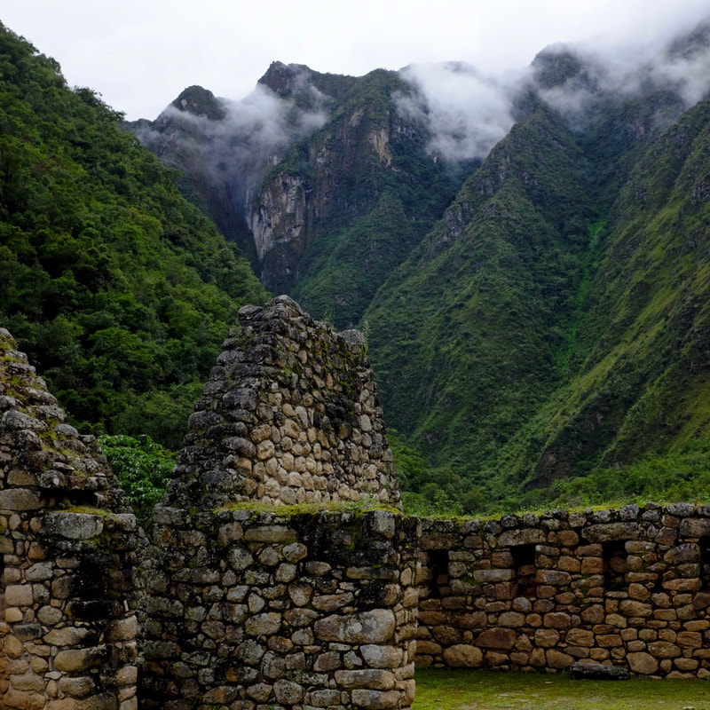
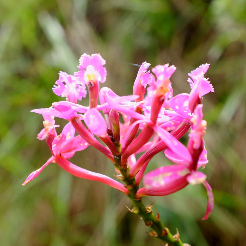
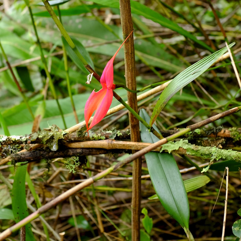
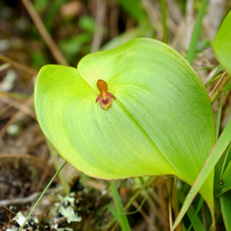
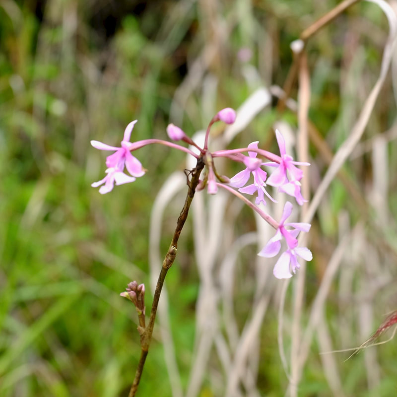
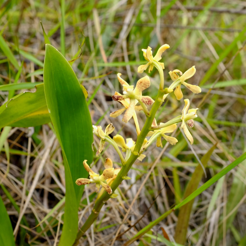
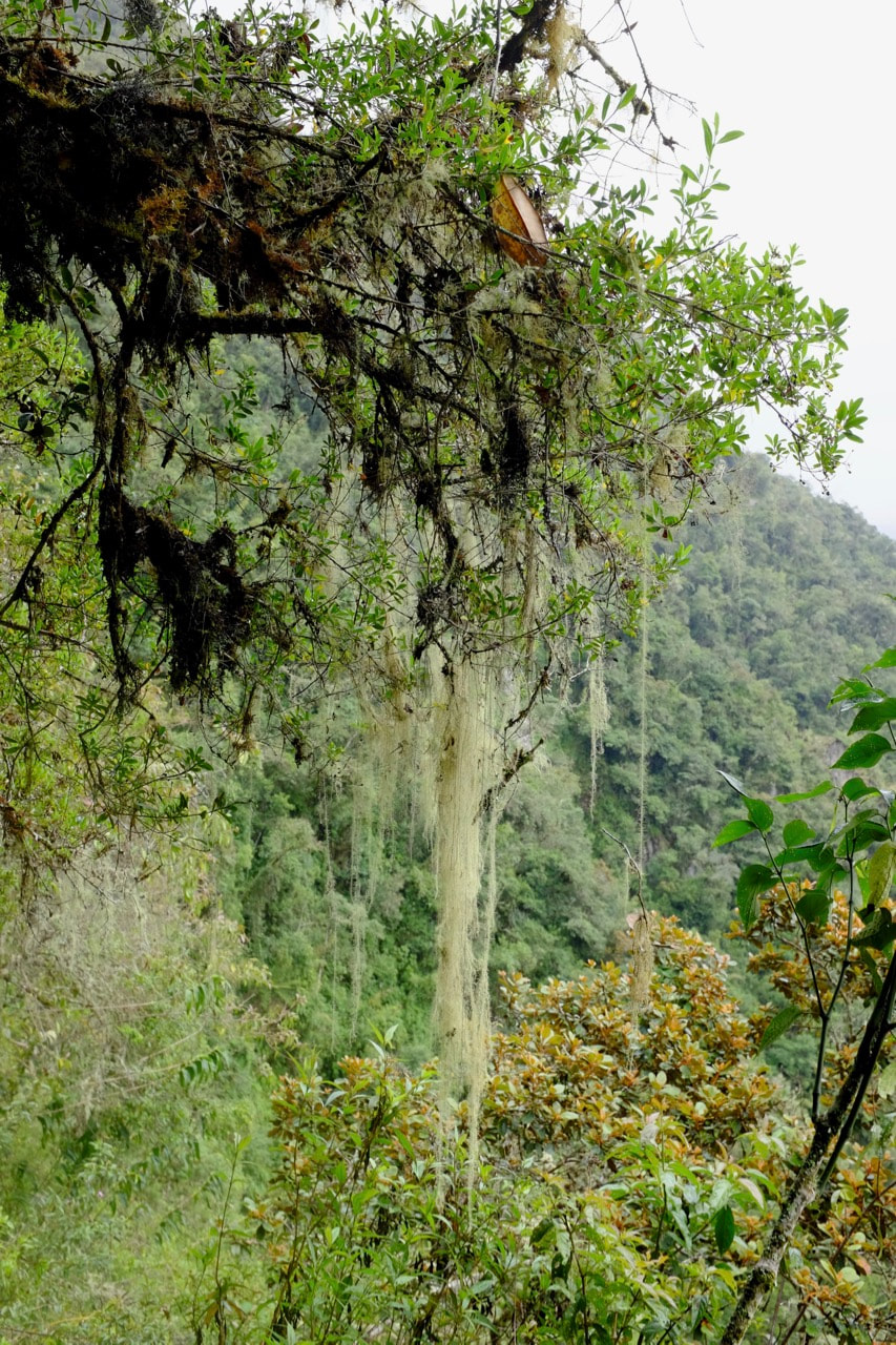
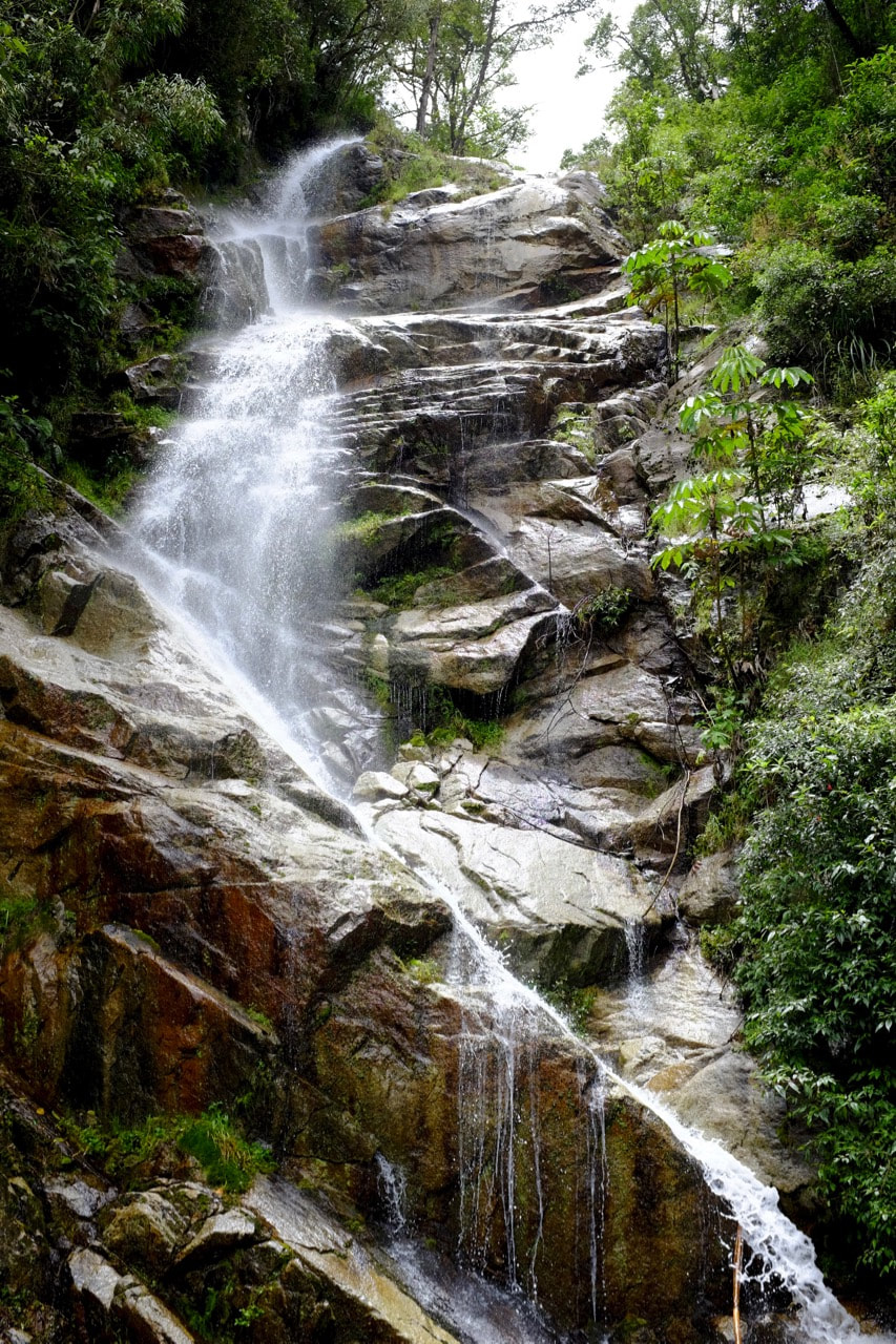
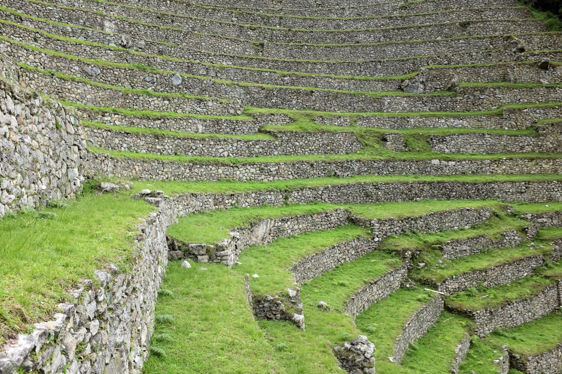
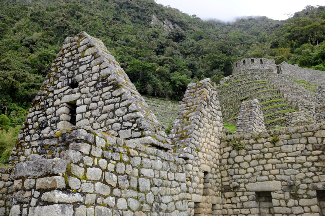
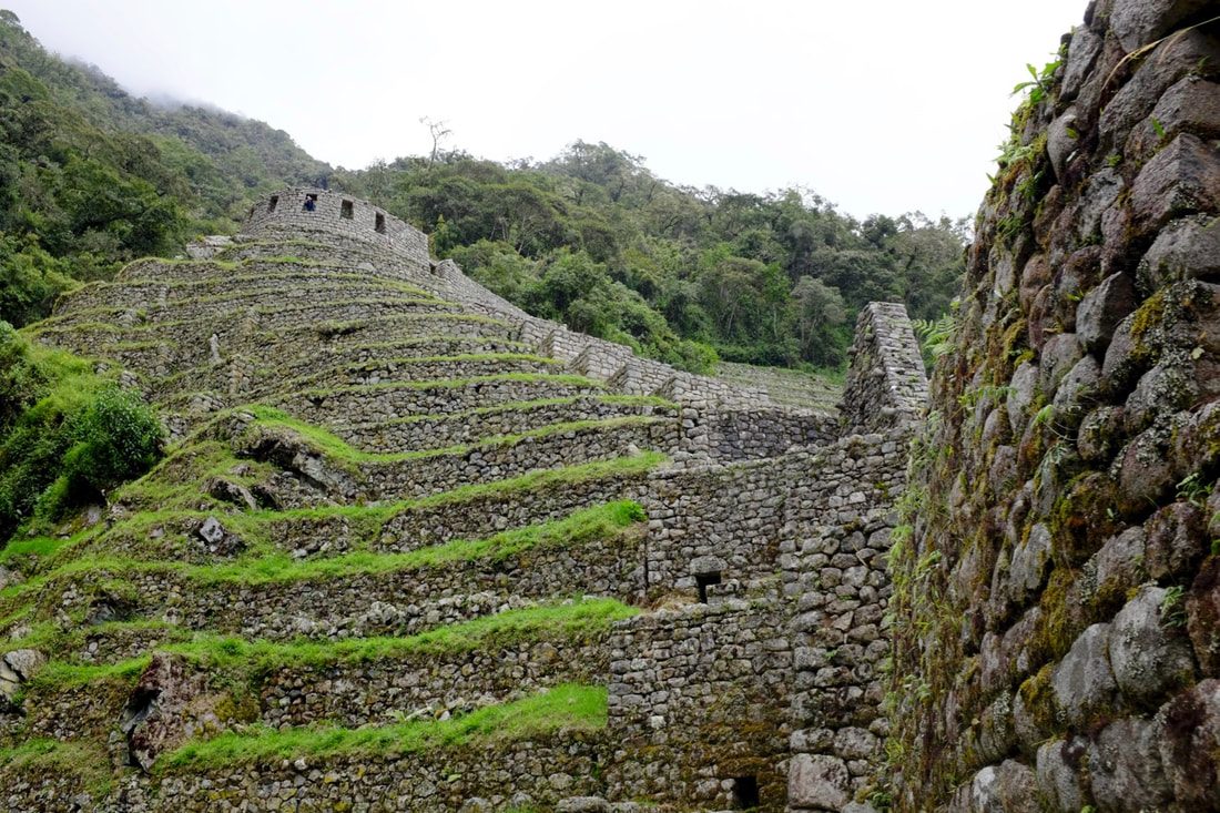
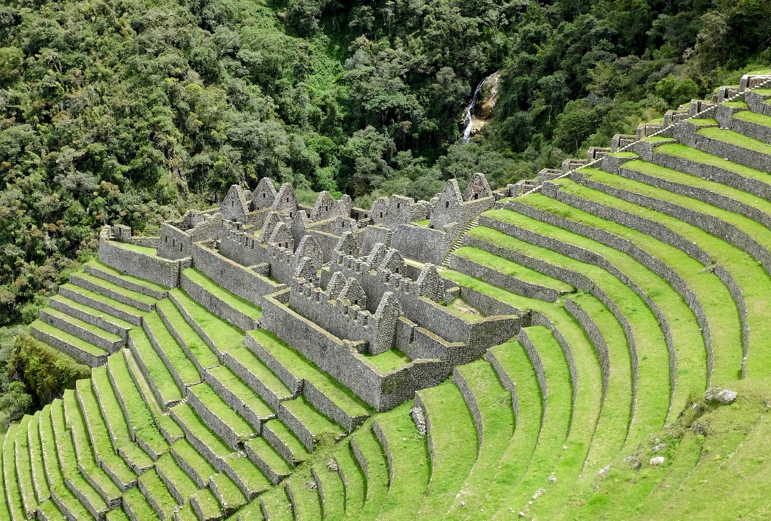
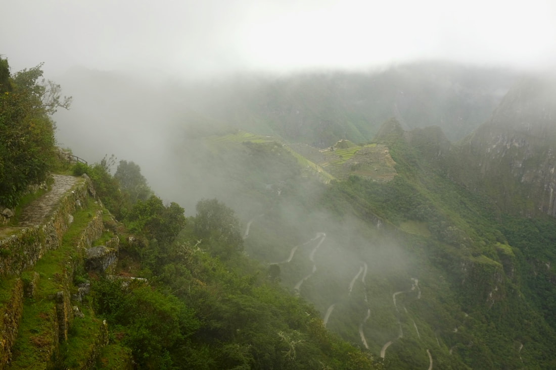
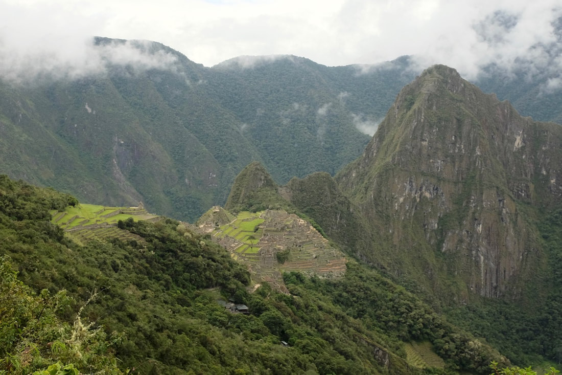
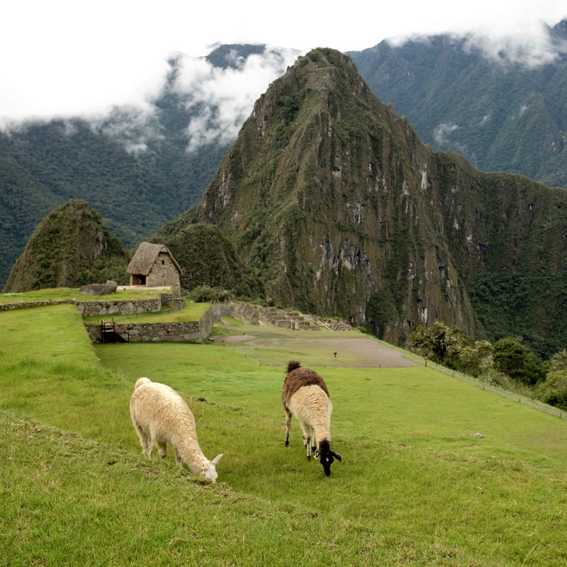
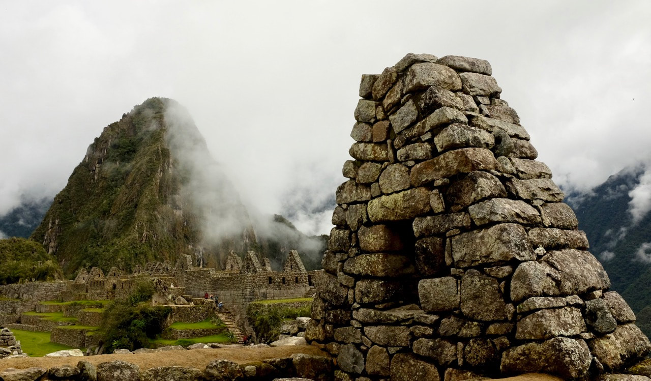
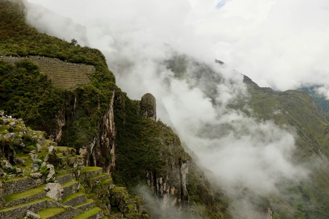
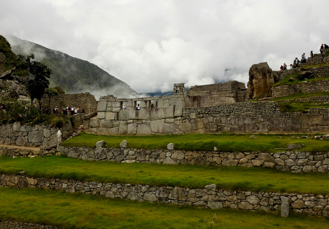
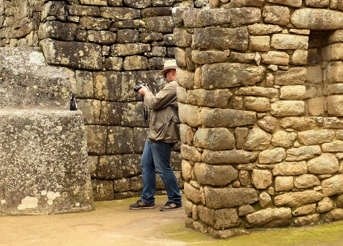
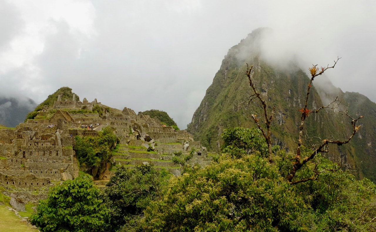
There are three ways of getting to Machu Picchu, unless you have a helicopter. The easiest way is to take the train from Ollantaytambo to Aguas Calientes, then to take the bus uphill. Alternatively, you can take the train part of the way and walk the rest. The fit and keen get off the train at km 82 and spend four or five days trekking; we got off at km 104 and walked around 10 km in a day. This has the double advantage that you get to see the view from Intipunku and avoid some of the hordes of tourists, while also sleeping in a hotel instead of a tent. 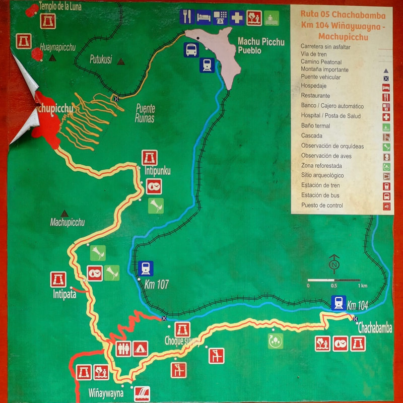 There's a handy map when you get off the train at Chachabamba The landscape is markedly different from further up the valley. The hills are covered in cloud forest, and there are no roads, only footpaths and the train line. Many hills still have visible signs of old Inca trails; some seemingly going straight up the side of a mountain, and there are some Inca terraces that have been uncovered, but there aren't signs of intensive agriculture as there were around Ollantaytambo. Maybe this is because everything that was there is now overgrown; or perhaps the cloud forest climate just isn't as suitable for crops. There's definitely almost no flat valley floor, and only a few small habitations scattered along the train line. The train stopped abruptly at km 104, where we climbed out onto the tracks, crossed the river, applied insect repellent, and used the last toilet for a very long time (S/1 each). We had a quick look around the Chachabamba ruins, and then headed uphill. There's a surprising variety of plants in the cloud forest, including several different orchids. About two hours after setting off, we rounded a corner to get our first sight of Wiñay Wayna, sitting high on a steep hillside. The name means "forever young" in Quechua, and is also the name of a variety of Epidendrum Secundum, the top left orchid above. We walked for almost another hour to reach the site itself, on the other side of a deep valley with a lovely waterfall at its head. It's not clear, as with a lot of Inca sites, what its original purpose was. There are large agricultural terraces, houses, and also some religious buildings. There are more pictures in the previous post. Three hours further on (including time for lunch) we made it to the highest point of our trek: Intipunku, the Sun Gate. Here, we should have had a spectacular first view of Machu Picchu, but instead it started to rain and we could only see clouds beneath us. Ten minutes later, though, the mist had cleared enough for us to get a view. Machu Picchu from the Sun Gate. Our path is on the left; the zigzag road leads down from MP to Aguas Calientes. The rain turned out to be a blessing: by the time we reached Machu Picchu, almost all of the tourists had left and we had the place (almost) to ourselves. We walked down through the ruins, and Susan took the bus into town. Stupidly, I decided to walk down instead. The road zigzags, but the path goes straight down the hill for around 2,000 painfully-high stone steps, cutting across the road several times. Our guide, Pepe, saw a bus driven by a friend and immediately bombed it straight down the path so that he could be waiting nonchalantly at the next bend of the road. I just continued down, thankful that we'd rented trekking poles and my knees weren't taking all of the punishment. Once you've reached the valley floor, the road continues into Aguas Calientes for another couple of long miles. It was getting dark by the time I reached the hotel, but thankfully I had time for a quick shower and to change my socks before dinner. The next day we negotiated a 7am start - Pepe wanted to get going at 6 - and took the bus back up to Machu Picchu. Apparently crazy people start queueing for the first bus well before dawn, but we decided sleep was more important than seeing the sunrise, especially as it was likely to be cloudy. There was a massive throng at the entrance to MP itself: it seemed as though normal tourist tickets came with a particular entry time, but our Inca Trail tickets got us through without having to queue up. Pepe gave us a tour of the outskirts of the site, occasionally shouting at tourists standing on fragile walls for that all-important selfie, and then pointed us towards the central, most crowded parts for us to explore on our own while he returned to Cusco (explaining why he'd wanted the early start). Finally, a few notes on logistics. We visited in the middle of January, but only confirmed our booking for the trek at the end of November, six weeks beforehand, and were rather worried that we'd left it too late. The Inca Trail has limited spots available, and they apparently fill up quickly, but maybe that's a bigger problem for the 4-day treks in high season. Another worry was that it would rain all of the time. The rainy season is November-March, with the wettest month being February, when the Inca Trail is closed for repairs. Luckily, though, we had some sun during the trek and a few mild rain showers, only adding up to what you might expect on a fairly dry day in the Lake District.
Guides are mandatory for Inca Trail treks. We booked through Llama Path - not the cheapest, but a very well known outfit that is notable for treating their staff ethically. Our guide Pepe was excellent, as was the packed lunch. Talking of packing, I both over- and under-packed. I took too many layers with me: while it was nice to have a fleece at night, I could have got by without it. I wish I'd have worn shorts during the hike, and packed a pair of trousers to wear once we arrived. It wasn't terribly nice to put my damp hiking trousers back on after showering in the hotel. We hired walking poles, which were very useful to take some of the strain off the knees while descending, as well as to steady ourselves when the path became slippery in the rain. Staying in Ollantaytambo both before and after visiting Machu Picchu meant that we didn't have to get up as early as if we'd been staying in Cusco, and that we could leave all the stuff that we didn't need safely in the hotel. It's also a good place to acclimatise to the altitude, being higher than Machu Picchu, but a significant 600m lower than Cusco. |